Project Description
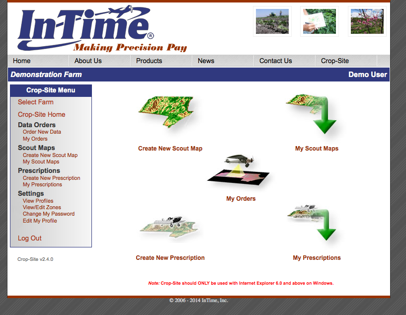
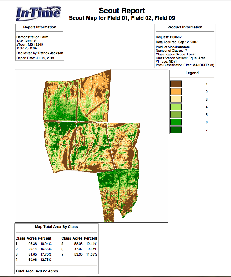
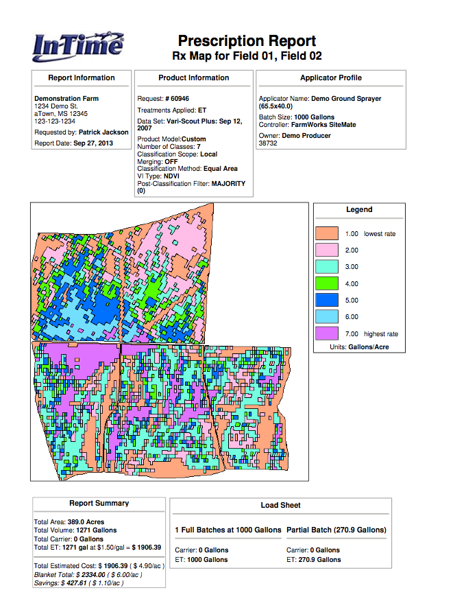
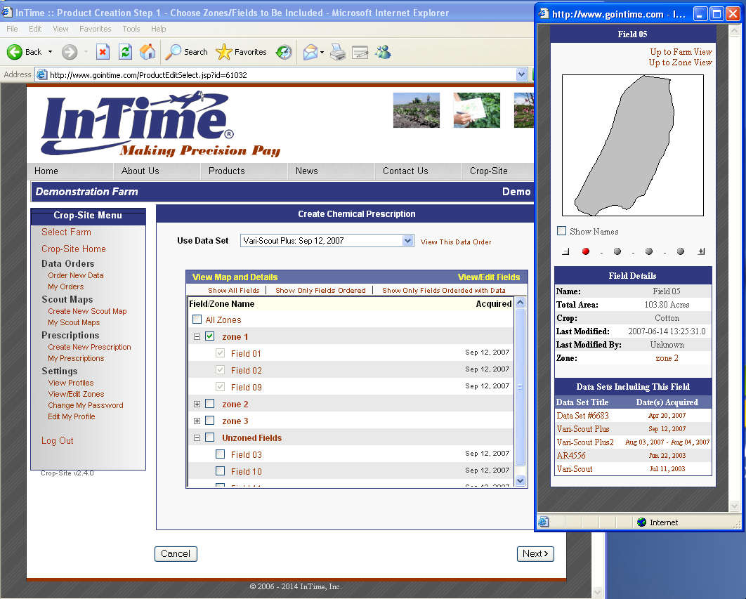
InTime is a pioneer in the field of Precision Agriculture. Their web-based, CropSite software uses Geographic Information Systems (GIS) technology combined with aerial imagery to create several kinds of digital map. Scout Maps help farmers to analyze their crops by showing variations in biomass in the field. Prescription Maps may be loaded on to specially-equipped chemical applicators to automatically vary the rate of chemical applied: they put more chemical where it’s needed, and less where it’s not.
Our role this year has been to perform maintenance on their existing system, fixing bugs, and updating their Java Applets to comply with security updates, etc.